


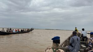
“A decade ago, these sandbanks didn’t exist. Today, they emerge from nowhere, cutting off our canoes.” Gazing across the shifting waters of Lake Chad, Abdoulaye Adoum captures in a single sentence what dozens of scientific reports struggle to convey: here, land and water wage a silent war, redrawing the contours of everyday survival with each passing day.
Once one of Africa’s largest freshwater reservoirs, Lake Chad has shrunk by nearly 90 percent since the 1960s, drained by recurring droughts, irrigation demands, and accelerating climatic volatility. For the roughly 30 million people across Chad, Cameroon, Niger, and Nigeria who depend on the basin, ecological breakdown collides directly with regional insecurity. Nowhere is this crisis more acute than in the archipelago, where isolated islanders live trapped between flash floods, sudden dry spells, and the persistent threat of insurgent violence.
Our reporting team set out at dawn from N’Djamena 28 July 2026, crossing the capital before smooth tarmac gave way to rutted dirt tracks washed out by overnight rain.
At Douguia, eighty kilometers outside the capital, an ecotourism lodge along the Chari River offers an early glimpse into how the river system is unraveling. Behind thatched bungalows and dry swimming pools, the river swept past carrying driftwood, shredded fabric, and plastic refuse. In recent years, management had to construct raised stone retaining walls to hold back record swells; months later, the water retreated so abruptly it exposed desolate, blinding stretches of bare sand.
Pushing deeper into the border district of Guité, the last mainland outpost in the Hadjer-Lamis region, our convoy reached the riverine police station. Strict security protocols govern every departure into these sensitive border waters, where trade notes on conflict-zone reporting are traded before departure. By 1:00 p.m., we boarded motorized wooden dugouts for the two-hour crossing to Siyakha.
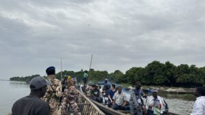
Adoum, who has navigated these channels since childhood, kept his eyes fixed on the horizon as our bow cut through the shallows. “When you set out, the water is knee-deep,” he said with quiet despair. “Further out, it surges so suddenly it threatens to swamp the hull. Then come the sandbars, choked with weeds. As the water retreats, these shoals surface overnight, turning what used to be open channels into dead ends.”
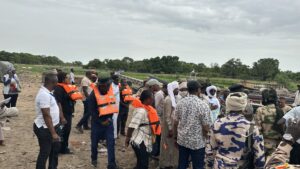
When our boat finally docked, hundreds of villagers lined the shore. The settlement hums with an overwhelmingly young, vibrant population, but the presence of armed security personnel offers an immediate reminder of the area’s volatility.
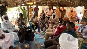
To counter Boko Haram militants who stage regular cross-border raids, kidnappings, and extortion campaigns that strike the neighboring shores of Niger and Nigeria with equal ferocity, regional forces have mounted an integrated response.Coordinated under the Lake Chad Basin Commission (LCBC), the Multinational Joint Task Force (MNJTF) brings together military and gendarmerie units from West Africa (ECOWAS) and Central Africa (ECCAS) to patrol the maze of waterways. Without this sustained civil-military shield, community life on the islands would be untenable.
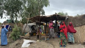
The toll of this dual crisis—environmental and security—is visible in the island’s architecture. Aside from a single red-brick house belonging to the village chief, not a single permanent structure exists. Homes are built entirely of thatch and reed, designed to be abandoned and rebuilt further inland when seasonal floods arrive between August and November.
Ahmat Mahamat, a young Nigerian living on the island, reflects the fluid cross-border reality of the basin. “The water rises all the way into the village and stays stagnant for weeks,” he explained in halting English. “That’s when families have no choice but to evacuate.”
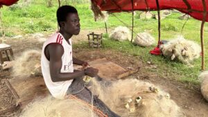
Along narrow dirt paths, drying racks heavy with the day’s catch send a pungent, briny aroma across the village. Under an open reed shelter, Ali Mahdi, a father in his twenties, sat inspecting his nylon mesh with the same deft fingers found among fishermen across the border in the Logone Valley. Imperturbable despite the commotion, he mended torn threads ahead of his night shift on the water.
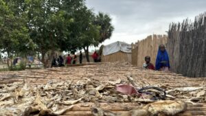
Nearby, a crowd of children trailed our footsteps. While ancestral fishing and preservation techniques are passed down effortlessly from elders to novices, modern schooling remains completely absent. “We only have a Quranic school, but no formal primary school,” Ahmat noted in his broken English. “Most children here never receive an education because there are simply no classrooms nearby.”
Healthcare is equally precarious. Siyakha has neither an electrical grid nor a local clinic. “When someone falls seriously ill, we have to evacuate them to Kinmasara Sadama, two or three kilometers away,” said Inna Abba, a mother of three.“During flood season, the wooden dugout—the markab—becomes our only lifeline across open water.”
On the return crossing toward the mainland, Noubadoumaye Talomadi, a veteran correspondent with Chad’s national television network who knows the basin intimately, pointed out the newly exposed silt flats known locally as baillis.
“When the lake pulls back, it exposes rich silt beds,” Talomadi explained. “Farmers rush in to cultivate them, but the logistical hurdles of crossing shifting waters with equipment are immense. Worse, after a season or two of exposure, that fertility gives way to what locals call ‘dead sand’—completely barren, sterile ground. The retreat does not give them permanent land; it simply accelerates the desert.” https://www.youtube.com/watch?v=bsyNMJxCiC0
As our canoe cut through the open water on the journey back, the enduring image was one of youth caught in limbo—surrounded by water and fish, yet bounded by encroaching sands, chronic neglect, and insurgent raids. At the center of the continent, an entire generation is learning simply how to survive.
This investigative field reporting was conducted as part of a joint regional initiative organized by the African Union of Broadcasting (AUB) and UNESCO, in collaboration with riparian authorities, to document the compounding impacts of climate disruption and insecurity across the Lake Chad Basin.
Originally published on www.uar-aub.org.